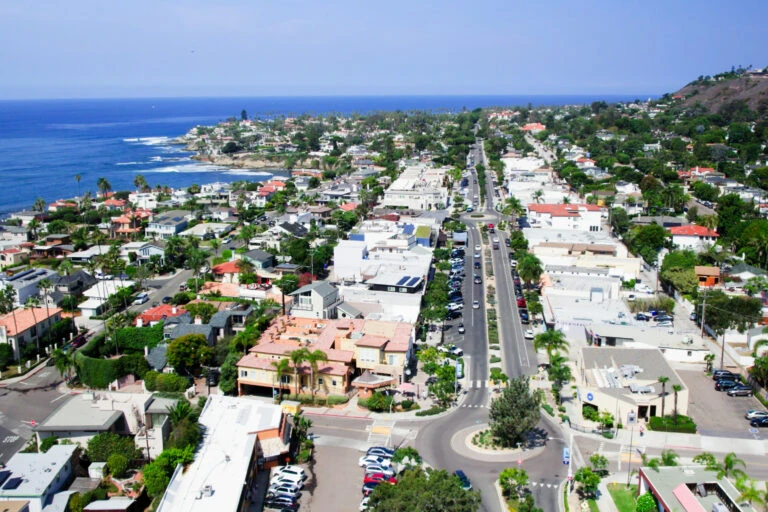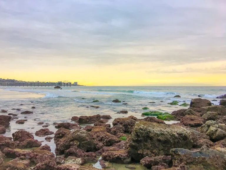

While La Jolla has its fair share of modern luxuries, we’re also lucky to enjoy ample opportunities to get outside and appreciate our community’s natural wonders. Torrey Pines State Natural Reserve is one of our special places, a stretch of protected coastal wilderness on the northern edge of town that people come to for the ocean views and the hiking trails. I live in La Jolla and have been visiting the reserve for decades.
Closed for construction
Closed to visitors until March 2027
The reserve is closed to all visitors from September 22, 2026, hikers and cyclists included. The closure covers every trail, the Beach Trail staircase, the Lodge and both upper parking lots while crews install new gas, water, wastewater and communication lines, and build accessible parking and pathways. State Parks’ construction project page says it is scheduled to reopen in March 2027.
Down at sea level, Torrey Pines State Beach stays open, and so do the North Beach and South Beach parking lots. Until the gates open again, this is a beach walk rather than a hike. My guide to San Diego hiking trails has the ones that are still open, and since you are already in La Jolla, my guide to what else to do in La Jolla can fill the rest of the day. Everything below describes the reserve as you will find it when it reopens.
About Torrey Pines State Natural Reserve
You might hear a lot of people call it Torrey Pines State Park. It is part of the California State Park system, but it’s actually a natural reserve.
A reserve protects land that holds threatened plants, animals, or habitats, so its rules are stricter than a state park’s and every visitor is asked to tread more carefully. Of the 280 units in the California State Park system, only 14 carry reserve status. Torrey Pines is one of them.
It is one of the most popular outdoor activities in San Diego and things to do in La Jolla.
The Rare Torrey Pine Tree
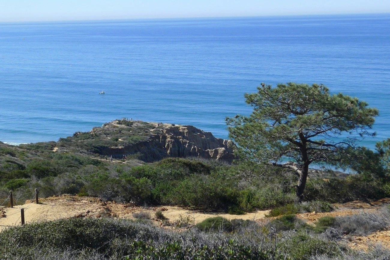
The Torrey pine (Pinus torreyana), the tree the reserve is named for, is the rarest pine in the United States. It grows naturally in two places and nowhere else, this strip of San Diego coastline and Santa Rosa Island off Santa Barbara. Everything about how the reserve is run comes back to that.
A Donation by Ellen Browning Scripps
There would not be a reserve at all without local philanthropist Ellen Browning Scripps.
The City of San Diego set aside 364 acres of pueblo land here as a public park in 1899. The ordinance that created it did nothing to protect the trees growing on it. When the land around the park started coming up for sale, Scripps bought two more pueblo lots between 1908 and 1911 for the sole purpose of keeping the groves standing, then willed them to the people of San Diego.
In 1921, she and the City Park Commission appointed Guy Fleming as the park’s first custodian. He had learned the work in the nursery and landscaping crews of San Diego’s exposition, and he protected the trees for years with no uniform and no badge before going on to run the state parks of Southern California. The gentlest trail in the reserve carries his name.
A special city election in 1956 handed the park to the state, which could protect it more strictly than the city could, and it became a state park in 1959. The name changed to Torrey Pines State Natural Reserve in 2007. The Torrey Pines Docent Society keeps the full history of the reserve, and it is where these dates come from.
The Lodge and Visitor Center
The Visitor Center and the Ranger Station share the pueblo-style Lodge, which opened in 1923 as a restaurant (no relation to the hotel down the road, The Lodge at Torrey Pines, one of my favorites in town). It is where a visit normally starts. Inside are exhibits on the plants, animals and geology of the reserve, a video about the place, free trail maps, and a small shop.
Torrey Pines Nature Reserve Location
The reserve sits at the north end of La Jolla, between the village and Del Mar. As you drive along the beach, the entrance is on the right, before the road inclines up the North Torrey Pines Road hill.
If coming from the south, you will pass the famous Torrey Pines Golf Course on your way from La Jolla and make a left at the bottom of the North Torrey Pines Road hill.
Coming off Interstate 5, the simplest approach is to exit at Carmel Valley Road, drive west about a mile and a half to the coast highway, turn left, and follow the beach for another mile.
Address: 12600 N. Torrey Pines Road, San Diego, CA 92037.
Torrey Pines Hours
Gates open at 7:15 a.m. and the reserve closes at sunset, so closing time moves through the year. In summer that is around 7:30 or 8 p.m. In fall and winter it is closer to 5 p.m. Everyone has to be out by then, cars included.
Torrey Pines San Diego Parking Instructions
There are two lots, and which one you use decides how your day starts.
South Beach or North Beach
| Lot | Where | Worth knowing |
|---|---|---|
| South Beach | N. Torrey Pines Rd | Main entrance, fills first |
| North Beach | Carmel Valley Rd | Separate fee, RVs park here |
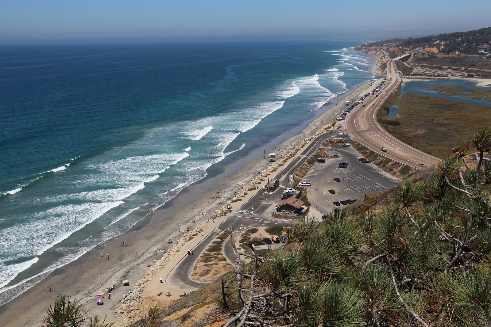
The day-use fee is demand based, so a weekend or a holiday costs more than a Tuesday morning. An annual California State Parks vehicle day-use pass covers it, as do the Golden Bear, Senior Golden Bear, Disabled Discount, Distinguished Veteran, Explorer and State Library passes. The Adventure Pass that fourth graders get is not accepted here, and the nearest park that takes it is Silver Strand State Beach in Coronado.
When the South Beach lot fills, staff close the entrance and send everyone north, which is worth knowing before you are the car being turned away. From North Beach you can reach the sand directly, or walk the path under the highway and over the bridge to South Beach in about 15 minutes. Driving between the two takes about five.
The South Beach kiosk is staffed from 9 a.m. until sunset. Arrive before that and you pay by QR code at the signs near the Lodge and the trailheads, and staff will help if the code will not scan.
Rideshare: State Parks asks that you meet your driver at the south entrance near the golf course maintenance area. Being picked up outside the South Beach lot is unsafe once traffic backs up, which it does on a warm weekend.
Torrey Pines State Natural Reserve General Rules
These rules come with the reserve’s protected status:
- Stay on the trails. Everything off them is the habitat the reserve exists to protect.
- No food or drink above the beach, water excepted. Carry your picnic down to the sand.
- Food is fine on the beach. Alcohol is not, anywhere.
- No dogs or other pets, in the reserve or on the state beach. Working service dogs are welcome, and State Parks asks that they be identified with a vest or tag.
- No drones anywhere in the reserve or over the beach.
- No smoking and no open flames. The plants here are dry and burn easily.
- No picking flowers or collecting pine cones. They are next year’s trees and this year’s food for the animals.
- No amplified music.
- Pack your trash out. The only bins are in the beach parking lots.
- Bikes may use the paved park road uphill only. No downhill riding and no bikes on the trails.
- Organized groups need a permit, arranged ahead of time by email.
- No camping, and no picnicking above the beach.
There are no restrooms on the trails. Flush toilets are at the beach parking lots, and portable toilets and handwashing stations sit at the west lot at the top of the hill. The portables are a stopgap while the construction project puts in permanent facilities.
Torrey Pines Hikes
Most of the trails here run under a mile. They link to one another, and nearly all of them end at an overlook or on the sand, which is why they turn up on lists of the best hikes in San Diego.
Staying on the trail matters more here than it does on most hikes. Rattlesnakes live in the scrub on either side of it, and the plants you would be stepping on are the reason the reserve exists. One slithered through my yard in La Jolla. The steeper trails also close after rain so the soil does not wash away, and how long they stay closed depends on how much fell.
These are the trails in the main reserve, with distances from the printed trail guide the reserve hands out at the entrance. Four more sit in the Extension.
If you only have an hour, State Parks suggests starting at the Visitor Center and walking the Guy Fleming loop. With half a day, add the Razor Point and Yucca Point overlooks, where people stand and watch for dolphins.
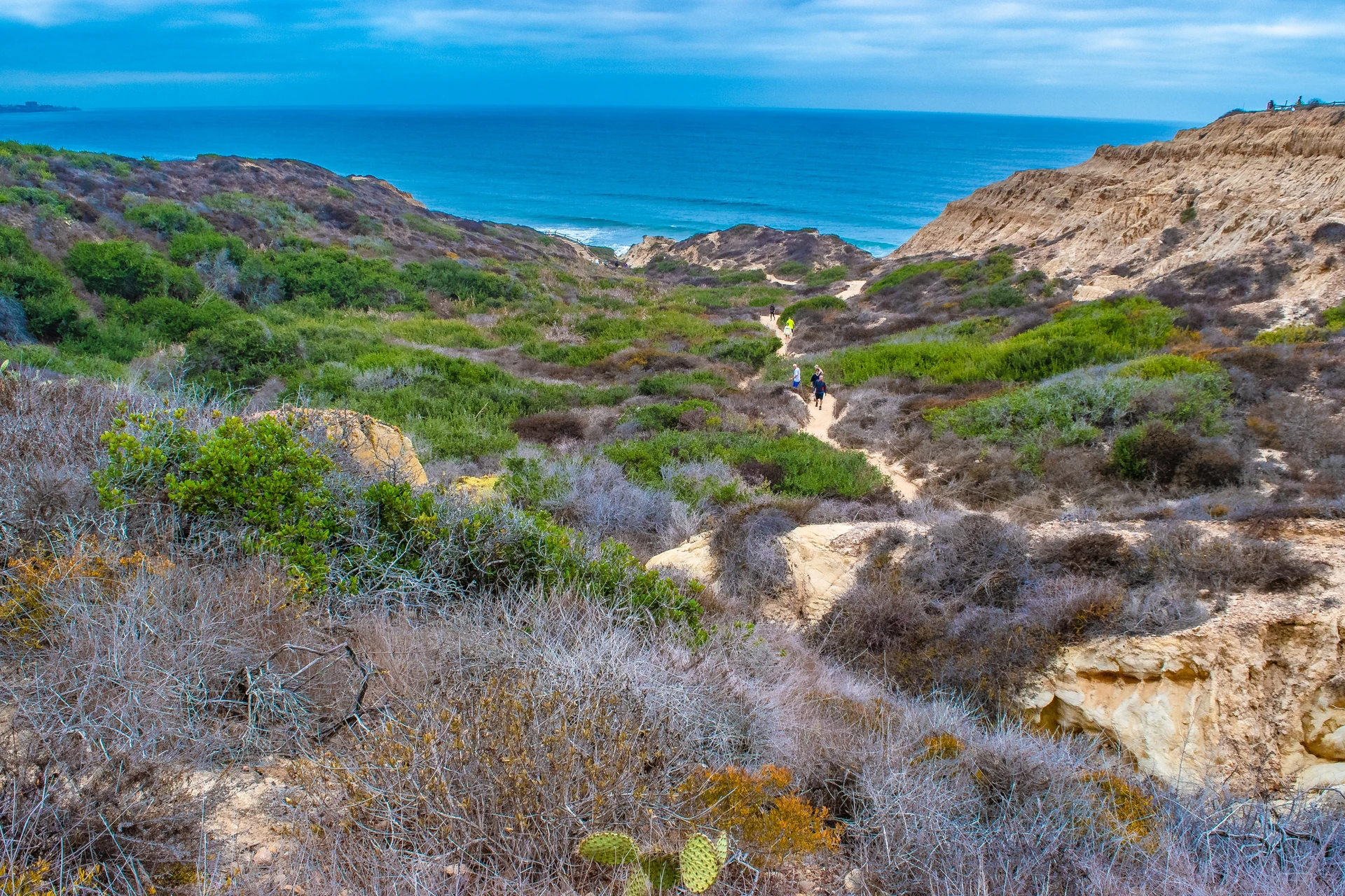
Every Trail at a Glance
| Trail | Length | Best for |
|---|---|---|
| Guy Fleming | 2/3 mile loop | Families, little kids |
| Parry Grove | 1/2 mile loop | Solitude, plus steps |
| High Point | 100 yards | Big view, least walking |
| Razor Point | 1/2 mile | Dramatic scenery |
| Beach Trail | 3/4 mile | Sand, busiest route |
| Broken Hill | 1 1/4 miles | Longer, quieter route |
Guy Fleming Trail
- Length: 2/3 mile loop
- Difficulty: Easy
- Best for: Families, small children, grandparents, and anyone who wore the wrong shoes.
No trail in the reserve holds a greater variety of plants and habitats than this one, and it is relatively level, with two overlooks along the loop that open onto panoramic views. The wildflowers, cacti and ferns draw wildlife, and so does the bird bath. Guy Fleming himself walked thousands of visitors around this loop, and the route was more or less trampled into place before the state ever formalized it.
Parry Grove Trail
- Length: 1/2 mile loop
- Difficulty: Moderate, with a steep entry and exit of more than 100 stone steps
- Best for: Walkers who do not mind going down a long flight of steps knowing they have to come back up them.
The Parry Grove Trail is the secluded one. Even on a busy day, you may have it to yourself. Drought and a bark beetle infestation in the 1990s took most of the Torrey pines in this grove, and it is still recovering, which is its own lesson in what the reserve is up against. The spring wildflowers are worth the steps. The Whitaker Garden of native plants sits at the trailhead.
Tip: The steps can be slippery so be careful.
High Point Trail
- Length: 100 yards, with steep steps to the lookout
- Difficulty: Moderate
- Best for: Anyone who can manage steps and wants the biggest view for the least walking.
One hundred yards of steps buys a panorama of the lagoon, the ocean, the whole reserve and the country inland. No other trail here returns that much for so little walking.
Razor Point Trail
- Length: 1/2 mile to the overlook
- Difficulty: Challenging
- Best for: Hikers who want the most dramatic scenery in the reserve.
This trail winds through the coastal scrub. The dramatic views of the sandstone gorge make this route memorable. The Yucca Point Overlook is loved for its yucca flowers in the spring and the sandstone tafoni (beautiful patterns created in the rocks due to erosion).
Beach Trail
- Length: 3/4 mile to the beach
- Difficulty: Challenging, with about 300 feet of descent and the same climb back
- Best for: Beachgoers happy to work up a sweat before they relax.
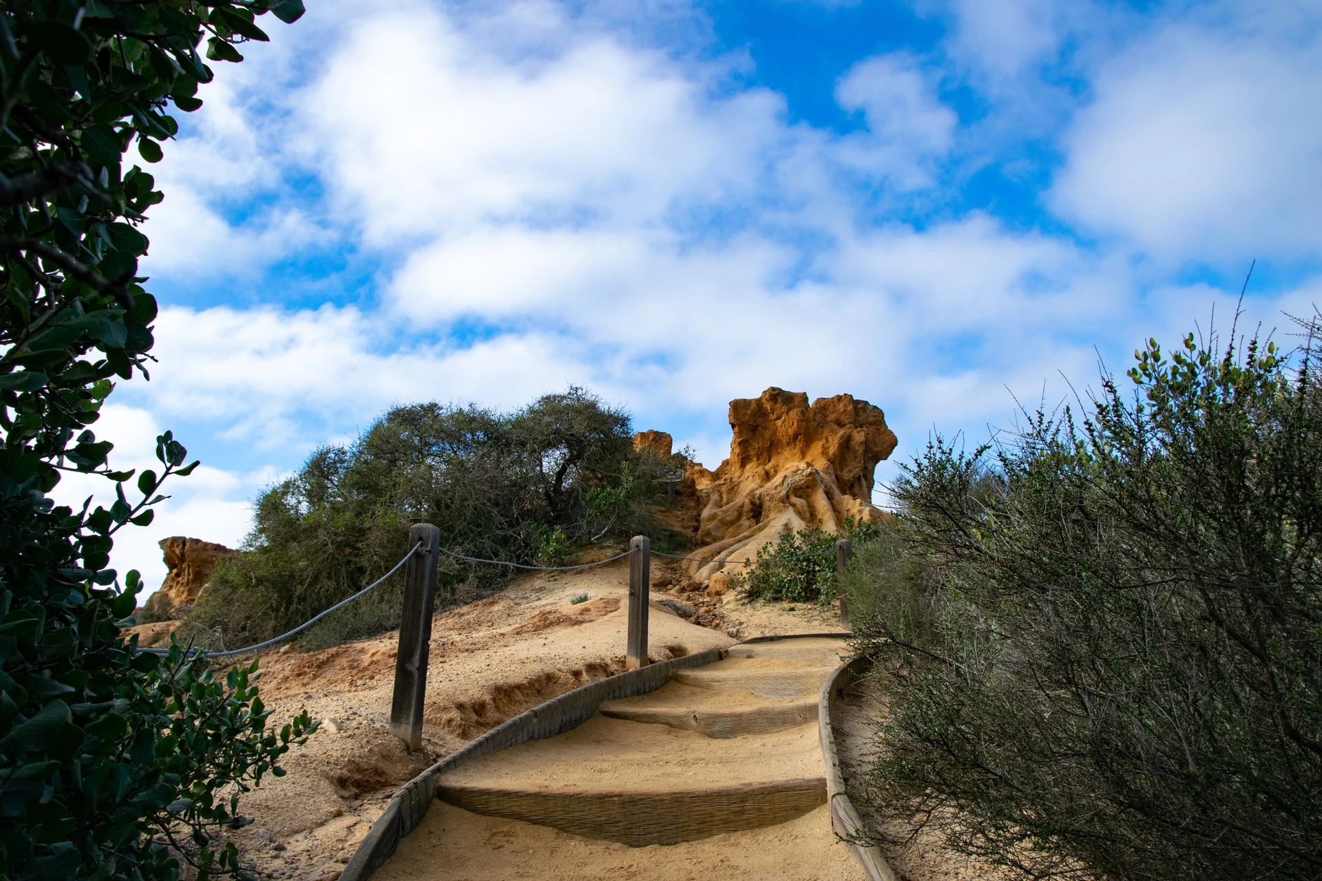
This is the popular way down to the sand. The footpath runs through the upper reserve and finishes at a staircase, and Yucca Point Overlook is on this route too. Staff will tell you there are three ways down to the beach: this one, which is the busiest, and the north or south fork of Broken Hill, which are quieter.
Broken Hill Trail
- Length: 1 1/4 miles by the north fork, 1 1/3 miles by the south fork
- Difficulty: Challenging, and the longest walk in the reserve
- Best for: Fit walkers and trail runners, and anyone who wants the quieter way down to the sand.
This is the longest trail in the reserve. It runs through chaparral and sagebrush to an overlook of eroding sandstone, then joins the Beach Trail just above Flat Rock, and the north fork passes a dense elfin forest on the way.
Tip: The path is narrow and runners use it, so listen for footsteps behind you and step aside where it widens.
Torrey Pines State Reserve Extension Trails
Most people hike the main reserve and never know the rest of it exists. When bulldozers started clearing Torrey pines on the north side of Los Peñasquitos Lagoon for housing, local conservation groups spent years raising the money to buy the land instead, and it is now the Torrey Pines State Natural Reserve Extension. Four trails run through it: Mar Scenic, the Daughters of the American Revolution trail, the Margaret Fleming Nature Trail and the Red Ridge Loop. They see a fraction of the traffic.
You reach the trailheads from Del Mar Scenic Parkway via Carmel Valley Road, or from Mar Scenic Drive or Mira Montana Drive via Del Mar Heights Road. Parking is free on the street near the trailheads, and there is no kiosk and no staff on this side.
State Parks publishes the current maps for both the main reserve and the Extension on its Torrey Pines park information page, along with the trail conditions after rain.
Free Guided Walks at Torrey Pines
Volunteer docents and park staff lead free nature walks that start at the front of the Lodge, and a gentler mindful walk sets off from the Guy Fleming Trail. Days and times shift with the season and with who is available. The State Parks page for the reserve is the only place the schedule is current.
Tip: Organized groups need a permit and a docent-guided hike arranged well ahead by email. Nothing is being scheduled while the reserve is closed.
Kids aged 7 to 12 can join the free Junior Ranger program, which runs 60 to 90 minutes on native plants, mammals, reptiles and insects. Most sessions are drop-in and a parent stays for the duration. If you miss one, the Visitor Center hands out a Junior Ranger activity book for ages 4 and up, and finishing it earns a stamp in a logbook you can carry to any other California state park.
Accessible Trails and the Beach Wheelchair
If someone in your group uses a wheelchair or you are pushing a stroller, the accessible routes are the Discovery Trail, the Ellen Browning Scripps Overlook, the West Overlook and the south fork of Broken Hill. There is also a free beach wheelchair for use at North Beach, checked out at the South Beach entrance kiosk.
Wildlife Sightings at Torrey Pines Park
Wildlife is the part children remember, and the reserve has plenty of it in the scrub on either side of the trails. Most of it moves early, before the trails fill up, which is one more argument for a morning visit.
Birds
Birds are what you will actually see. About two hundred species are protected here, because Los Peñasquitos Marsh below the bluffs is one of the last salt marshes and waterfowl refuges left in Southern California. Watch for red-tailed hawks and ospreys riding the thermals off the cliffs, pelicans over the water, and California quail gathered in coveys on fall and winter mornings.
Mammals
Most of the mammals here are nocturnal or keep well away from people, so the ones you meet are the ones that have made peace with visitors. California ground squirrels and cottontail rabbits turn up along every trail.
Gray foxes, bobcats, coyotes and mule deer live here too, and State Parks describes seeing them as occasional. If one crosses in front of you, count the morning a good one. From the bluffs you also have a decent chance at dolphins year round, and at gray whales during the winter migration.
Reptiles and Snakes
Lizards are the reptile you will notice, basking on the sandstone from spring through summer. Snakes mostly stay out of sight. Rattlesnakes do live here, and State Parks names the southern Pacific and the red diamond as the two you are most likely to meet.
Tip: If you do see a rattlesnake on the trail, stop and wait for it to move off. It felt you coming long before you saw it and usually leaves on its own. If it does not, turn around, take another route, and tell a park employee or volunteer.
Torrey Pines State Beach
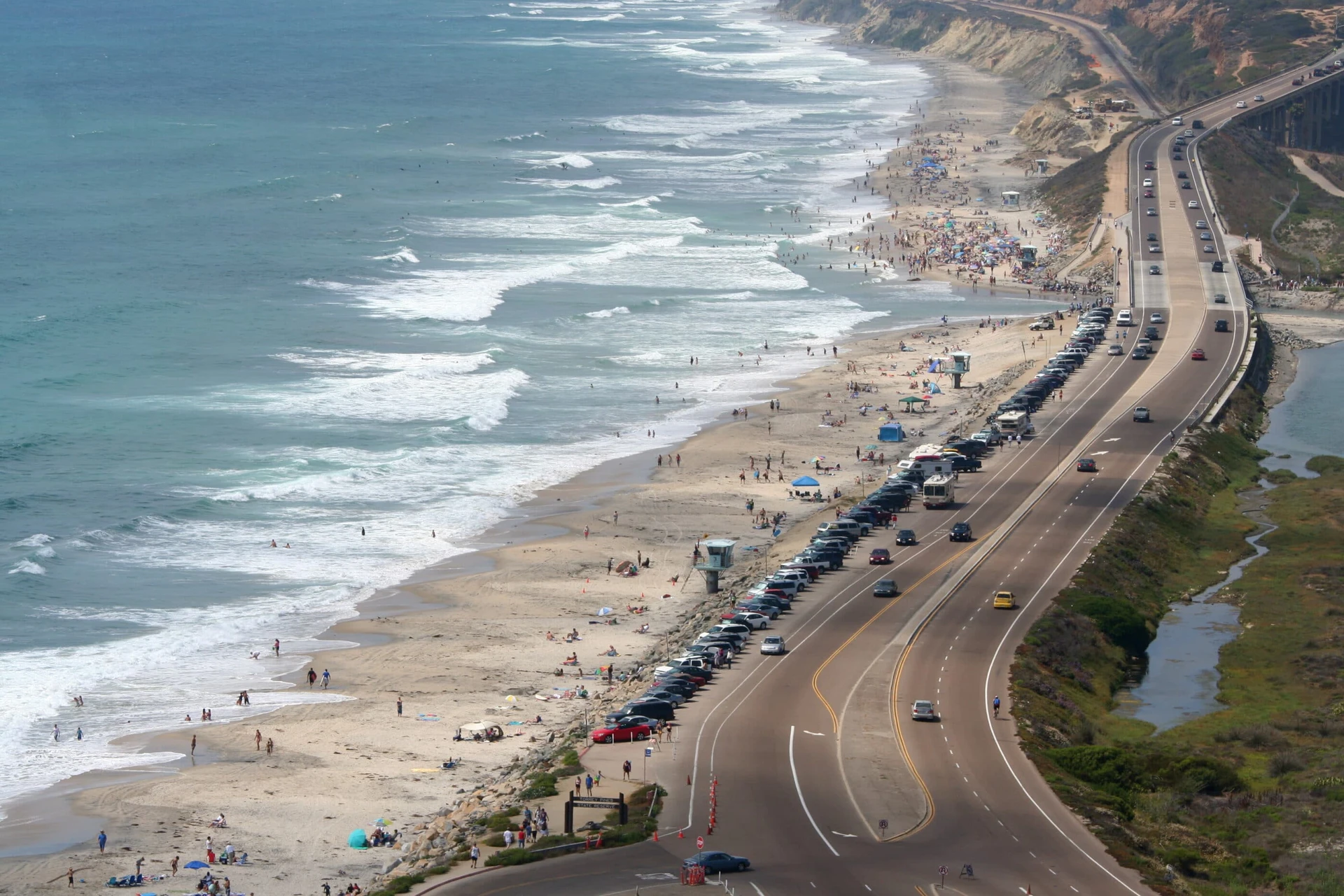
Torrey Pines State Beach runs four and a half miles north from the mesa toward the Del Mar beaches, and it is open right through the construction closure along with both of its parking lots. Finishing the Beach Trail in the water is the reward the whole walk is built around, when the trail is open.
Paragliders from the Torrey Pines Gliderport drift along the cliffs above while you swim or sunbathe, and they are free entertainment for kids. Keep well away from the base of the bluffs, though. Rockslides and cliff collapses happen here without warning, and State Parks asks visitors to stay at least ten feet clear and to time a beach walk for low tide, when there is more sand between the cliffs and the water.
Walk south from the base of the reserve and you eventually reach Black’s Beach, known for its nude sunbathers and its heavy surf break, but only when the tide is low enough to let you through.
Torrey Pines FAQs
Is Torrey Pines State Natural Reserve in La Jolla?
Yes. The reserve sits at the north end of La Jolla, and La Jolla is part of the city of San Diego, which is why State Parks prints the address as 12600 N. Torrey Pines Road, San Diego.
Is Torrey Pines a state park or a reserve?
It is part of the California State Park system, and within that system it is designated a state natural reserve, one of only 14. That designation is the reason the rules are stricter here than at a state beach, with no dogs, no food above the sand and no bikes on the trails.
Are dogs allowed at Torrey Pines?
No. Dogs are not permitted in the reserve or on Torrey Pines State Beach, and that still holds while the beach is the only part open. Working service dogs are welcome. State Parks sends dog owners to Del Mar Dog Beach, or to the trails at Crest Canyon, Carmel Mountain, Gonzales Canyon and Los Peñasquitos Canyon.
Are there bathrooms at Torrey Pines?
There are flush toilets at the beach parking lots, and portable toilets with handwashing stations at the west lot up top. There are none on the trails, so go before you start down.
How much does it cost to visit Torrey Pines?
The fee is charged per vehicle, so what you are paying for is the parking. It is demand based, which means weekends and holidays cost more than weekday mornings, and the two lots are charged separately. An annual California State Parks vehicle day-use pass covers either lot.
A Few Things You Might Not Know
- The two wild stands of Torrey pines sit about 175 miles apart, and botanists still argue about why. The theories run from birds carrying seeds to plate tectonics to one ancient woodland that covered the coast between them.
- The trees were called Soledad Pines, or solitary pines, until 1850.
- Dr. Charles Christopher Parry, a botanist on the US and Mexico boundary survey, renamed them that year for his mentor Dr. John Torrey. Torrey never saw them. Parry sent him seeds, cones and branches instead.
- The Kumeyaay lived on this land for thousands of years before any of it was named.
- During World War II the Army leased 750 acres of the mesa from the city for Camp Callan, an anti-aircraft training center. The golf course sits on part of it now.