
This curated list of the best things to do in La Jolla is based on decades of living here, raising a family, and exploring the places that truly make this seaside community special. My recommendations blend personal favorites with input from neighborhood kids, trusted friends, local concierges, and the many visitors I’ve guided through La Jolla and the greater San Diego area.
Most of the experiences below are clustered along the coast and in The Village (our downtown area), making it easy to combine several into one outing without much driving. You’ll find a mix of iconic attractions, tours, and dining, along with some of La Jolla’s best experiences that are completely free after you park.
I’ve linked to more detailed guides where helpful. For a broader overview of where to stay, eat, and explore, you can also use my full La Jolla travel guide. If you’re traveling with children, I have a dedicated guide to La Jolla with kids, and budget-conscious visitors should check out my list of free things to do in La Jolla
La Jolla Shortlist: The Five Must-Dos
If you only have a day, these are the most popular activities.
- Wildlife: Start at La Jolla Cove to see the view and sea lions. Then, walk south on the boardwalk to Children’s Pool to see the harbor seal rookery.
- Signature Adventure: Kayak the La Jolla Underwater Park, where clear water, sea caves, bright orange Garabalty, and other fish make this San Diego’s most iconic paddle. (Leopard sharks appear seasonally in summer)
- Culture: Explore the oceanfront galleries at the Museum of Contemporary Art San Diego (MCASD).
- Classic Activity: Take a surf lesson at La Jolla Shores, where the wide beach and gentle waves are good for all ages.
- Views: Hike the Razor Point Trail at Torrey Pines or try the Coast Walk Trail in The Village for panoramic ocean scenery.
1. Spend the Day at La Jolla Shores Beach
Location: 8300 Camino del Oro, La Jolla, CA 92037
Cost: Free (parking meter or lot fees apply)
Time needed: 2-4 hours or a full day
Best time to visit: Arrive before 10 a.m. on summer weekends
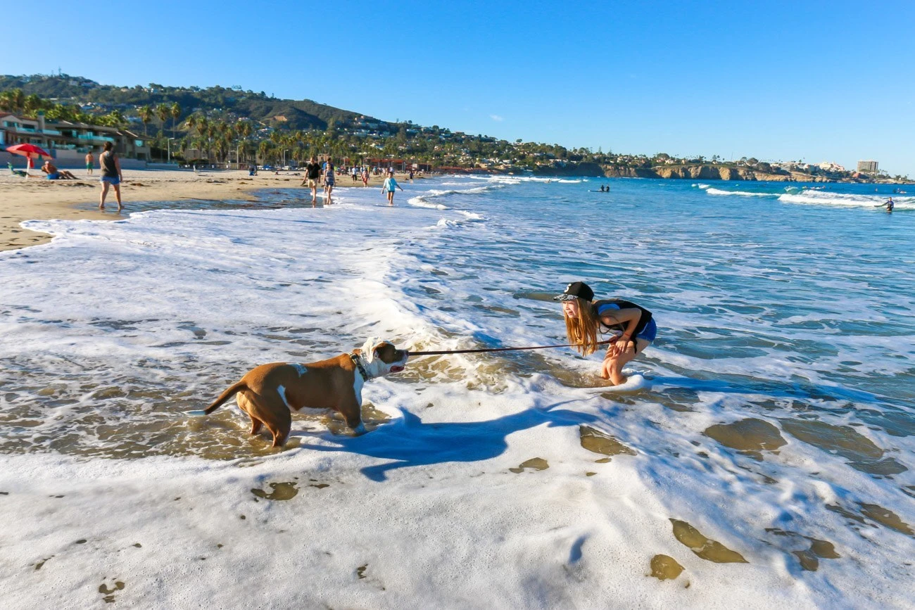
I send people who want to spend a fun day at the beach to La Jolla Shores Beach. It’s the biggest stretch of sand we have. There is space for everyone to spread out, even on crowded days.
I like it because:
- The ocean is typically excellent for swimming.
- Surfing is allowed on the north side, and the waves usually break in a way that makes learning how to surf here easier than on other beaches. You should book lessons through reputable, licensed companies like Surf Diva.
- A playground and a huge grassy area called Kellogg Park are adjacent to the beach.
- You can also walk to several convenience stores and excellent restaurants in the La Jolla Shores business district, a few blocks away. (Grab a sandwich at The Cheese Shop and bring it to the beach.)
The parking lot fills up quickly on peak days. I suggest taking an Uber or arriving early. You can also park on the residential streets. Depending on the season, dogs are allowed before 9 a.m. and again after 5 or 6 p.m.
See also: Best San Diego Beaches From North to South
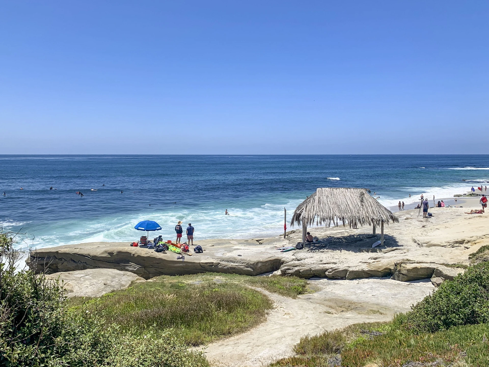
2. Explore the La Jolla Underwater Park by Kayak, Snorkeling, or SUP
Location: Enter at La Jolla Shores Beach or La Jolla Cove
Cost: Free to swim or snorkel on your own; guided kayak tours from ~$50–$80 per person
Time needed: 2–3 hours for a guided tour
Best time to visit: Summer for leopard sharks; mornings for calmer water
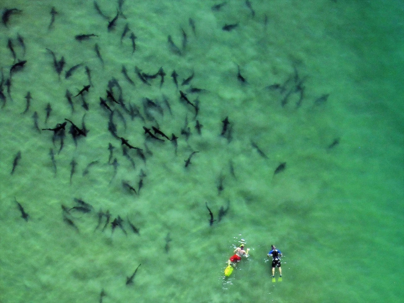
La Jolla Shores Beach is also an entry point to the San Diego-La Jolla Underwater Park, a protected ocean area. It’s full of marine life, including magnificent kelp, orange garibaldi (California’s state fish), leopard sharks, rays, and more.
You can explore it via these fun outdoor activities:
- Swimming out from the beach. A kayak is easier.
- Joining kayak or snorkeling tours departing from La Jolla Shores Beach that go to our famous seven sea caves.
- Stand-up paddleboarding
- Scuba diving
You can fish in some areas, but you need a fishing license. Bring your underwater camera for some fantastic adventure photos.
Swim with Leopard Sharks!
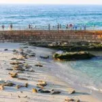
3. Visit La Jolla Cove Beach and Sea Lions
Location: 1100 Coast Blvd, La Jolla, CA 92037
Cost: Free
Time needed: 30 minutes to 2 hours
Best time to visit: Morning for fewer crowds; any season for sea lions

La Jolla Cove is our most popular attraction and is free to visit. I love it because:
- The little beach for sunbathing and swimming is surrounded by rocky points on both sides, where sea lions and birds hang out. In my experience, the chatty sea lions are always there unless it’s raining.
- Tide pools appear at low tides (but I think they’re better a bit further south).
- The usual lack of waves makes it easy for scuba divers and snorkelers to enter the water.
- It’s kid-friendly and protected year-round by lifeguards.
- You don’t have to walk on the sand to appreciate its natural beauty. I often walk on the coastal sidewalk that wraps around La Jolla Cove and goes south to the Children’s Pool. As you stroll the area, you’ll see plenty of ocean and some wildlife without getting your feet sandy.
- You can continue your visit with shopping, dining, and other activities in downtown La Jolla.
See also: My La Jolla Cove guide takes a deeper dive into how to get there, parking, and what to do.
Give Our Seals and Sea Lions Space
4. See the Famous La Jolla Seals at the Children’s Pool
Location: 850 Coast Blvd, La Jolla, CA 92037
Cost: Free
Time needed: 20–45 minutes
Best time to visit: December through May for pupping season; late afternoon for golden hour photos
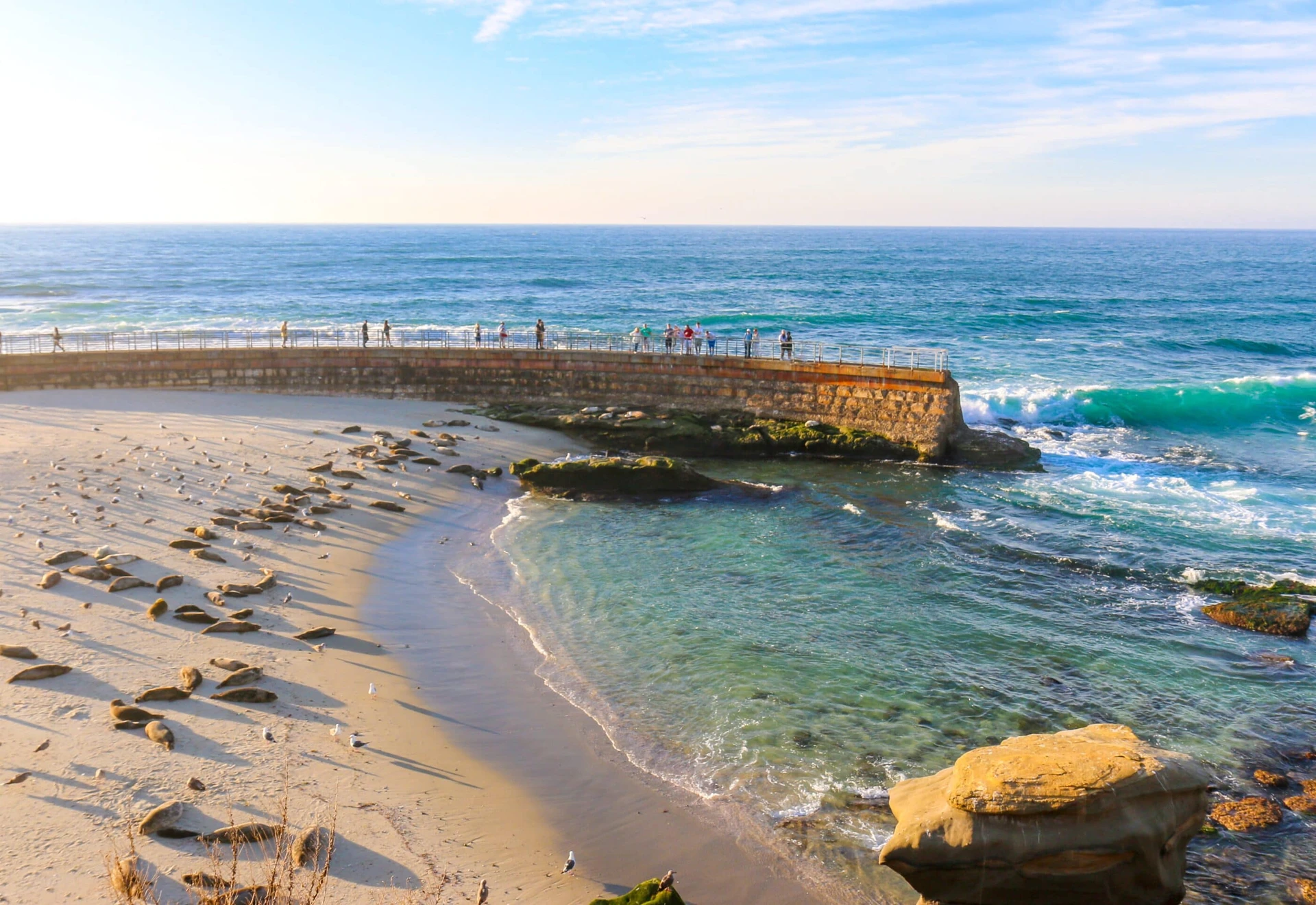
The famous La Jolla seals live at the Children’s Pool. Originally, the seawall here was built in the 1930s by philanthropist Ellen Browning Scripps to create a safe place for children to swim. Over time, the area filled with sand, and harbor seals moved in.
December 15 through May 15 is pupping season. A rope barrier on the sand protects the seals and their babies from humans during this timeframe. This is my favorite time of year to visit. It’s easy to take fantastic photos of the seals from a respectful distance.
People love watching the seals sleep, chat, and hobble around on the sand. If the waves are calm, you can walk onto the sea wall (but it can be slippery, so I don’t recommend this for young children). Visiting Children’s Pool Beach is, by far, one of the most popular things to do in La Jolla. I go here as much as I can.
5. Hike Torrey Pines State Natural Reserve
Location: 12600 N Torrey Pines Road, La Jolla, CA 92037
Cost: Free entry; parking $10–$25 per vehicle (demand-based pricing)
Time needed: 1.5–3 hours
Best time to visit: Early morning or late afternoon; weekdays are less crowded
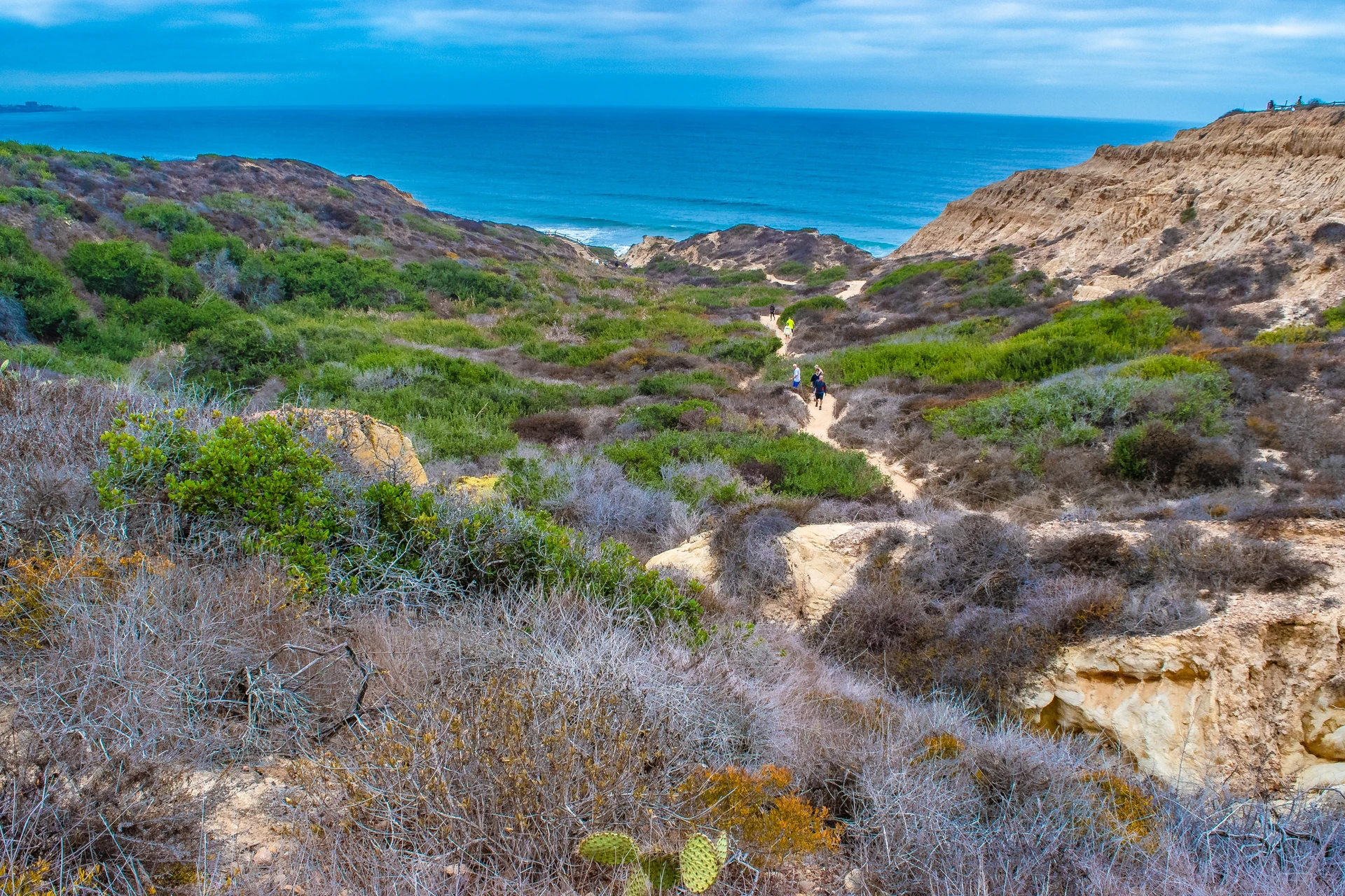
Torrey Pines State Natural Reserve is one of the few parks in our state system with reserve status. Many rare plants, like the Torrey Pine tree, and threatened animals live here. You’ll go on mild-to-moderate hikes, and there are some family-friendly trails.
It’s on the border of La Jolla and Del Mar, above gorgeous beaches, which means you may see dolphins or even whales during their annual migrations. Even if you don’t see any animals, the view is amazing. I have a few tips:
- You can bring in water but not food.
- Dogs are not allowed.
- Bring your camera and a charged phone.
- The park is open every day from 7:15 a.m. until sunset.
- Kids can earn Junior Ranger badges during their visit, and guests can join free small-group guided walks on weekends and holidays at 10 a.m. and 2 p.m. and on Fridays at 10 a.m. (summer only). Check the schedule before going, as the walks do not occur if the trails are closed.
- Parking can be tricky, and you’ll need to pay. I suggest Uber on busy days.
Plus, you can enjoy Torrey Pines State Beach below the reserve after you’ve exhausted the hiking trails on your list.
6. Learn About Local Marine Life at Birch Aquarium at Scripps
Location: 2300 Expedition Way, La Jolla, CA 92037
Cost: From $39.95 adults, $34.95 children (3–12); free for ages 2 and under. Save $5 by purchasing online.
Time needed: 1.5–2.5 hours
Best time to visit: Weekday mornings are the least crowded; right at opening or the last hour before closing
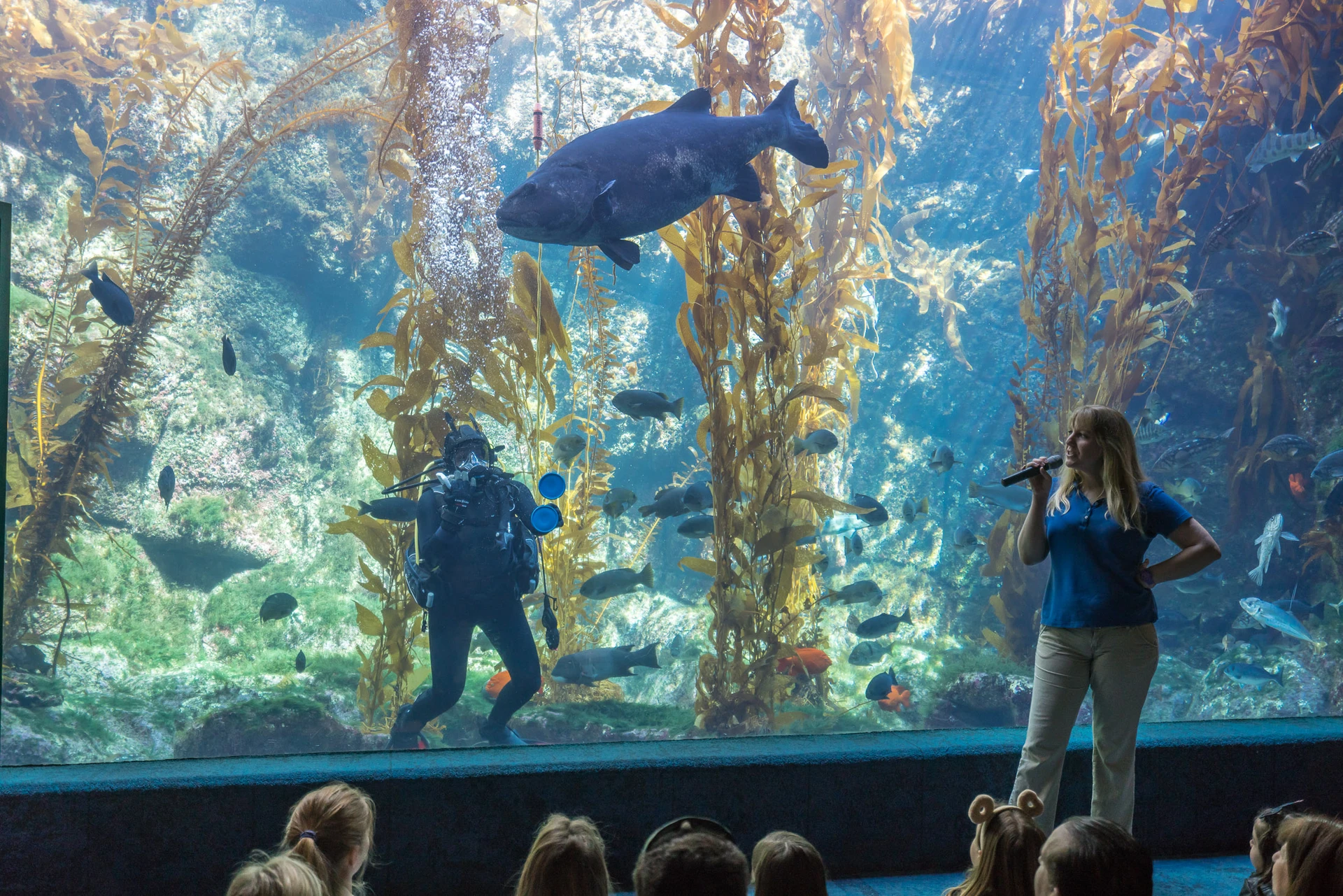
If you want to know what to do in La Jolla with kids, please add this to your list. Birch Aquarium at Scripps is not your average aquarium. It’s the public outreach center for the world-famous Scripps Institution of Oceanography at UC San Diego, where they showcase climate, earth, and ocean discoveries.
I have a lot of families who take day trips to La Jolla to go here because their kids are interested in marine biology. Top highlights include:
- Over 60 habitats of fish and invertebrates from the Pacific Northwest to Mexico and beyond.
- The Little Blue Penguins are so adorable to watch!
- A cool tide pool display on the outdoor patio (in addition to a spectacular panoramic ocean view), where docents share tidbits about the creatures living in them, such as sea stars, sea cucumbers, hermit crabs, and more. You can even touch some of them.
- Hands-on exhibits that kids love
I highly recommend checking the calendar for behind-the-scenes and off-site programming. It’s so, so good.
Pro Tip for Tickets
Birch Aquarium at Scripps is part of the Go City San Diego Pass, a sightseeing pass with discounts to major theme parks, tours, museums, and other fun activities. It is also a part of the San Diego CityPASS.
See also: Best Guide to Birch Aquarium at Scripps
7. Step Into Sunny Jim Sea Cave
Location: 1325 Coast Blvd, La Jolla, CA 92037
Cost: $13 adults, $7 youth (3–17)
Time needed: 20 minutes
Best time to visit: Early morning on weekdays to avoid lines; expect waits on summer weekends
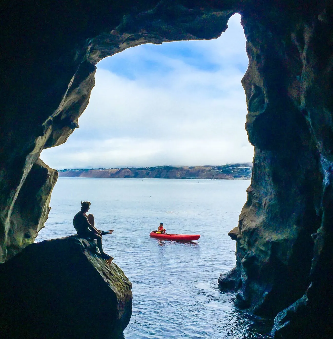
Sunny Jim Sea Cave is the only sea cave in California that you can go into from land. The old wooden staircase leading into the cave is inside the Cave Store on Coast Blvd. in the Village of La Jolla.
A platform inside the cave allows guests to hear the barking sea lions and rumble of the ocean. The view is pretty as well. You only need about 15–20 minutes or less to buy a ticket, walk down, see the sea cave, and walk back up. Except I’ve seen lines of people lately waiting to go inside.
Be careful because the stairway is old and slippery. It isn’t great for unstable walkers, but it’s a quick side experience when visiting the nearby seals.
Interesting Fact
Sunny Jim was also named by Frank Baum, the author of The Wizard of Oz, because the cave’s opening looked like a mascot for a British cereal, also called Sunny Jim. To give you a quick idea of how long people have been able to go inside, work on the tunnel to connect the sea cave to land began in 1902!
8. Picnic or Play at Ellen Browning Scripps Park
Location: 1100 Coast Blvd, La Jolla, CA 92037
Cost: Free
Time needed: 30 minutes to 1.5 hours
Best time to visit: Anytime, but sunset is especially beautiful
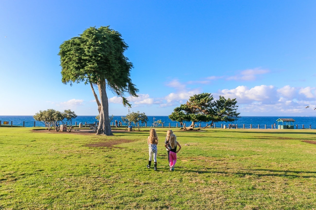
This large grassy area has windblown trees that are said to have influenced the Truffula trees in The Lorax, written by La Jolla’s most famous resident, Dr. Seuss.
It doesn’t get too crowded unless there’s a major event happening. It’s a great place for kids to run freely, have picnics, play frisbee, go for dog walks, do yoga, and more. The small green huts along the shoreline, called belvederes, are fun to hang out in.
This park is next to La Jolla Cove and a handful of small beaches, namely Boomer Beach (where the sea lions are) and Shell Beach. You can walk along the coast and go south to the Children’s Pool.
9. Experience the Museum of Contemporary Art San Diego, La Jolla
Location: 700 Prospect Street, La Jolla, CA 92037
Cost: $25 adults, $20 San Diego residents, $15 students/seniors; free for ages 25 and under (Qualcomm Foundation) and free on 2nd Sundays and 3rd Thursdays
Time needed: 1–2 hours
Best time to visit: Thursday through Sunday (closed Mon–Wed); free days for budget visitors
The Museum of Contemporary Art San Diego (MCASD) is housed in a newly renovated building that was the former home of local philanthropist Ellen Browning Scripps.
The ocean views from here are spectacular, as is the contemporary art collection. Be sure to check the schedule in case a free public tour or other similar event is happening. Thanks to the Qualcomm Foundation, ages 25 and under get free admission!
Don’t miss the gift shop and ocean view dining at The Kitchen.
10. Take Photos at Scripps Pier
Location: 8650 Kennel Way, La Jolla, CA 92037 (walk down to the beach)
Cost: Free
Time needed: 30 minutes to 1 hour
Best time to visit: Early morning or sunset for the best photos
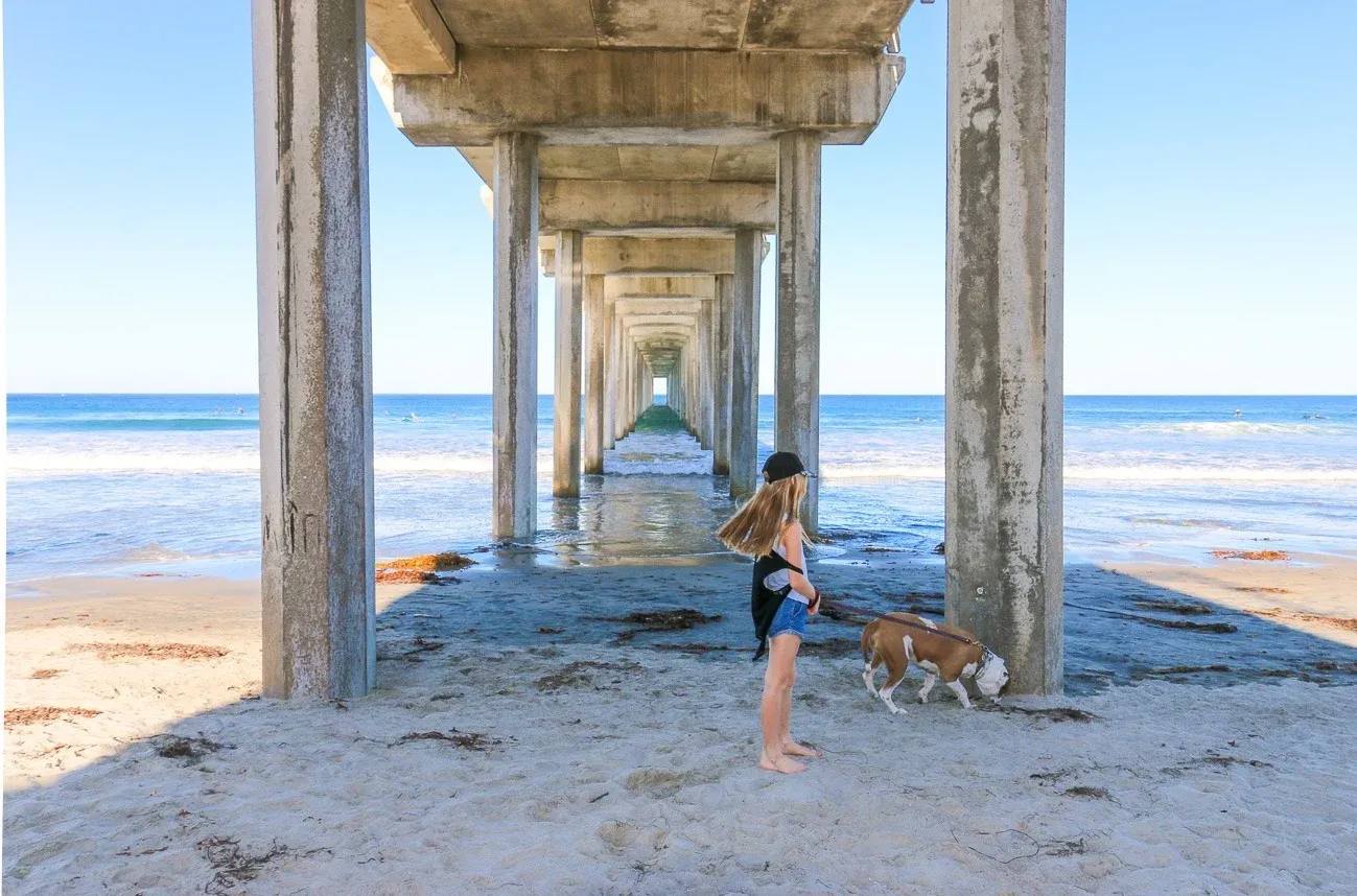
Head to La Jolla Shores Beach and walk north on the sand to the Scripps Pier. It is one of the world’s largest working piers. Scientists at the Scripps Institution of Oceanography use the pier to monitor changes in the Pacific Ocean and study marine life. The pier also pumps about 1.8 million gallons of seawater into the institution’s tanks.
This is one of the most popular places to take photos in La Jolla and the entire San Diego area. People take family portraits, Instagram photos, and more here. Snap a pic underneath the pylons or near the pier first thing in the morning or at sunset for a postcard-worthy shot.
Full Moon Pier Walks are occasionally available to the public through Birch Aquarium. Otherwise, you can’t walk on the pier.
11. Play with the Family at La Jolla Recreation Center
Location: 615 Prospect Street, La Jolla, CA 92037
Cost: Free (some classes may have fees)
Time needed: 30 minutes to 2 hours
Best time to visit: Afternoons on weekdays for fewer crowds
For us, La Jolla Recreation Center was a great place to run around after preschool. My daughter and her friends still love the play structures and bolting across the blacktop to play wallball. Fun all-ages activities include:
- Shooting hoops on the basketball courts.
- Practicing tennis solo on the backboards.
- Playing pickleball and bocce ball.
- Reading or having lunch at the picnic tables.
- Letting kids enjoy the multiple playgrounds.
- Taking classes ranging from theater to karate.
With your driver’s license, you can check out some balls and sports equipment from the office. Locals should remember to check their calendar of events.
This is not a must-visit place for a vacation. But it’s perfect if you’re staying at one of the nearby La Jolla hotels with kids who need to burn off steam. The Museum of Contemporary Art is across the street.
12. Walk the Stuart Collection of Public Art at UC San Diego
Location: 9500 Gilman Drive, La Jolla, CA 92037 (general UCSD address)
Cost: Free (pay for campus parking if driving)
Time needed: 1–2 hours for the full collection
Best time to visit: Anytime; weekdays have easier parking
Stuart Collection
UC San Diego
Photo: Philipp Scholz Rittermann
The Stuart Collection is an amazing series of public art on the campus of UC San Diego (my alma mater). After parking, it’s free to explore the collection. Searching for the sculptures around the campus is like an outdoor scavenger hunt, perfect for you or your kids.
The sculptures are enormous. Some are integrated into buildings and existing landscaping. Download and print a map that will guide you around campus in a roughly circular route to see the entire collection.
13. Watch Gliders or Fly Tandem at Torrey Pines Gliderport
Location: 2800 Torrey Pines Scenic Drive, La Jolla, CA 92037
Cost: Free to watch; tandem paragliding flights from ~$200+
Time needed: 30 minutes to watch; 1.5–2 hours for a tandem flight
Best time to visit: Midday when winds are favorable; check conditions before booking a flight
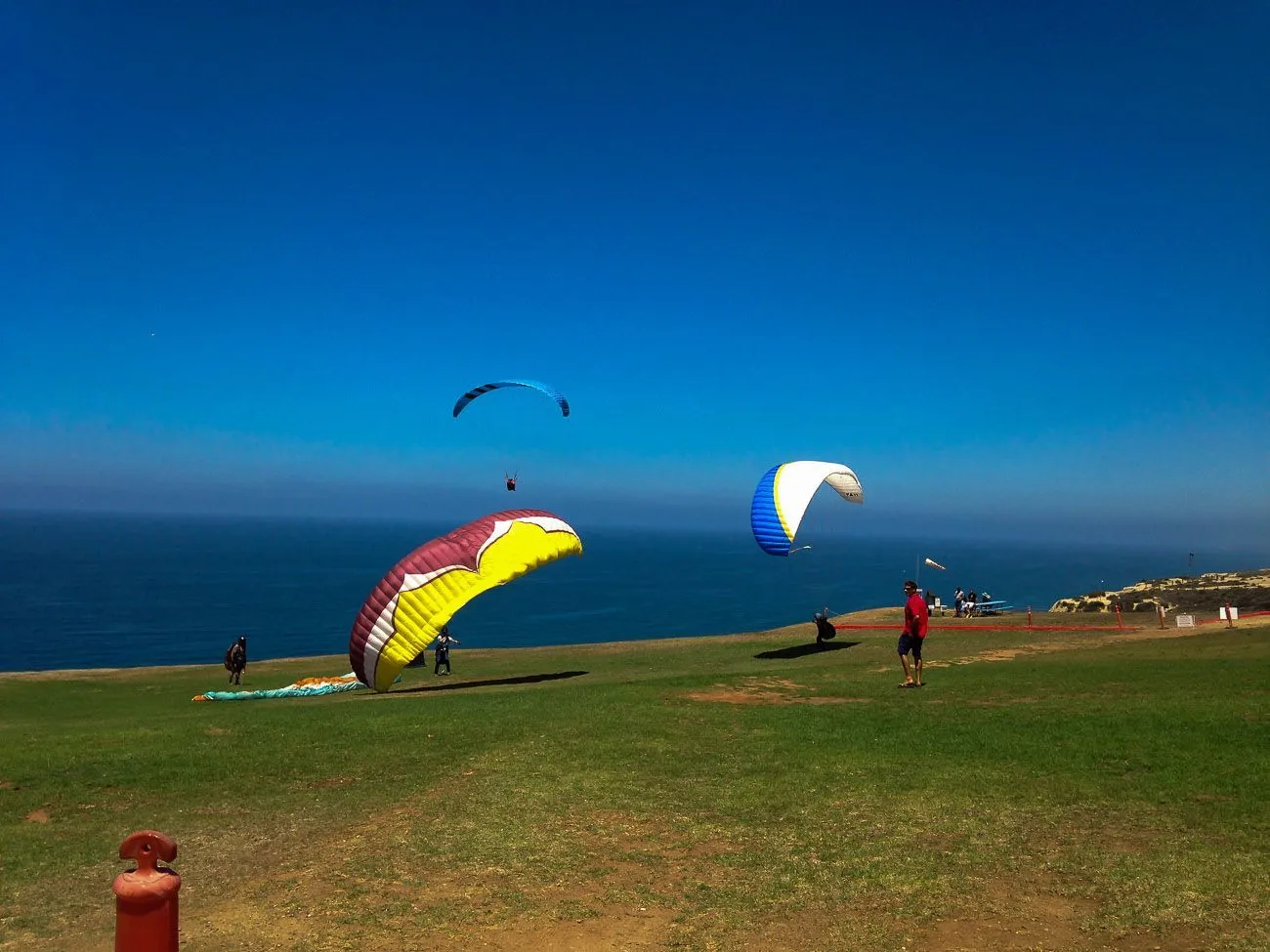
Torrey Pines Gliderport is a hidden gem worth visiting, even if you have no intention of paragliding or hang gliding off the cliffs. You can book tandem rides, and instructors will give lessons to those who want to learn to fly solo.
It’s one of the most historic aviation sites in the country, with over 100 years of flying history. Most people come to see the panoramic ocean views made even more spectacular by colorful gliders in the sky. I find it very relaxing.
You can bring a picnic, but the counter-order Cliffhanger Cafe here makes good sandwiches. They also now have a bar and sometimes live music.
It’s a super casual experience, and there is usually plenty of parking in the dirt lot. It’s located near UC San Diego, so people come for lunch after hiking at Torrey Pines State Natural Reserve or visiting Birch Aquarium.
Black’s Beach is located below the Gliderport. A moderately challenging .6-mile out-and-back trail leads down to it. Keep in mind that part of this beach is clothing-optional!
14. See Live Theater at La Jolla Playhouse
Location: 2910 La Jolla Village Drive, La Jolla, CA 92037
Cost: Varies by show; typically $25–$95+
Time needed: 2–3 hours, including intermission
Best time to visit: Check the performance calendar; book tickets in advance
The Tony Award-winning La Jolla Playhouse is on the UC San Diego campus. Some of its productions eventually make it big on Broadway (I saw Rent here decades ago and was a season ticket holder until parenthood got in the way).
When visiting La Jolla, be sure to check the calendar of events to see if there are performances that interest you.
15. Tee off at Torrey Pines Golf Course
Location: 11480 N Torrey Pines Road, La Jolla, CA 92037
Cost: Varies; non-resident rates from ~$200+ for the South Course
Time needed: 4–5 hours for 18 holes
Best time to visit: Book tee times well in advance, especially for the South Course

When your search for what to do in La Jolla revolves around golf, this is the most exclusive and popular place to snag a tee time.
Visitors come to La Jolla to follow Tiger’s footsteps and play at the famous Torrey Pines Municipal Golf Course. It’s home to San Diego’s prestigious annual PGA golf tournament, the Farmers Insurance Open.
The City of San Diego owns the two courses, which border the ocean for spectacular views. You can call for reservations or use a new online booking portal. Check rates and full tee time details.
Secure a Tee Time and Other Perks
Golf Services at The Lodge at Torrey Pines, which I recommend as one of the best hotels in San Diego, helps overnight guests secure tee times. People stay at the hotel because they like being close to this championship golf course. And, I can add on benefits like complimentary breakfast for two and more.
16. Visit Mount Soledad Veterans Memorial to Pay Respect and See the View
Location: 6905 La Jolla Scenic S Drive, La Jolla, CA 92037
Cost: Free
Time needed: 30 minutes to 1 hour
Best time to visit: Clear days for the best views, and mornings to avoid haze
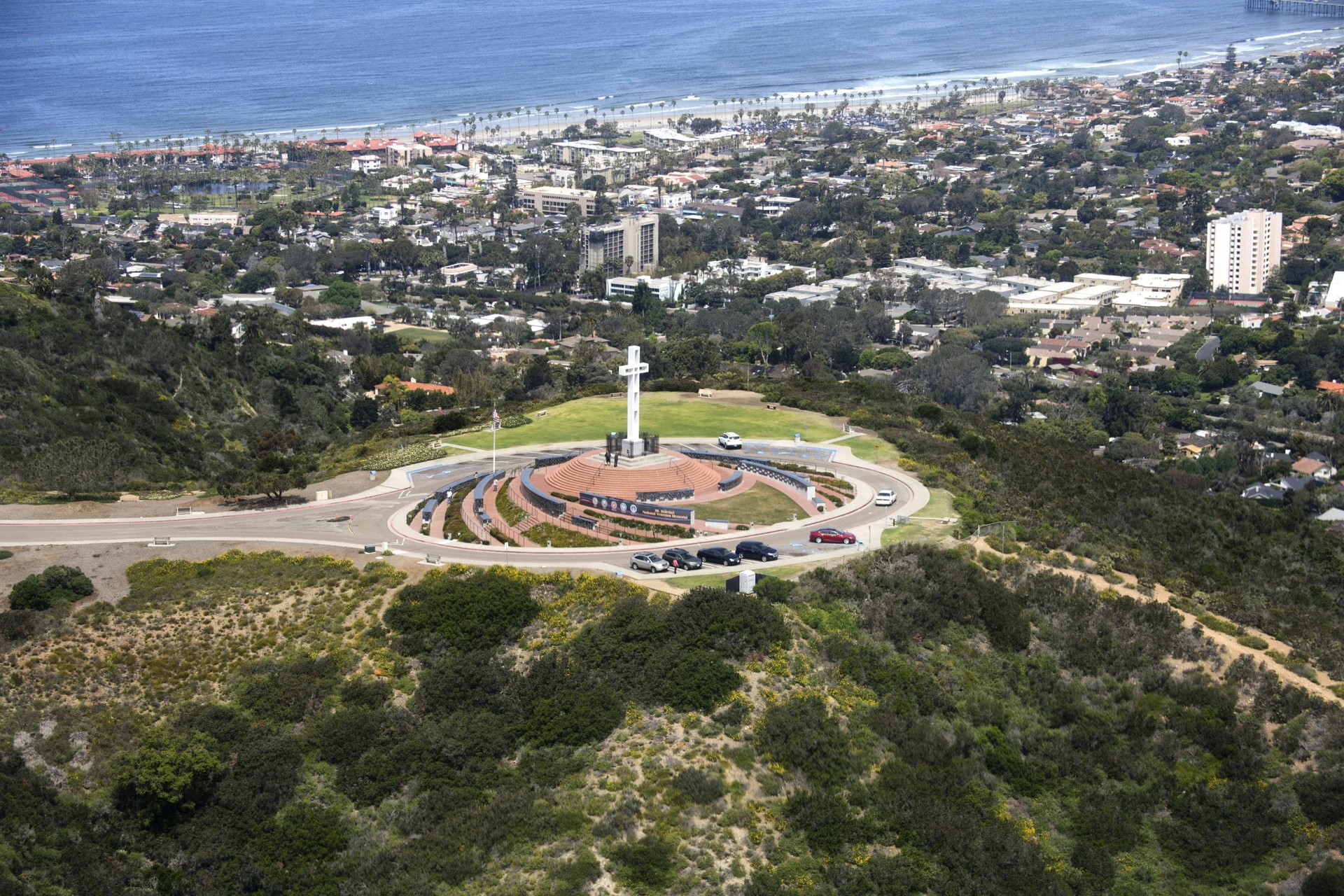
One of San Diego’s best views is from the Mount Soledad Veterans Memorial. Perched on the top of Mount Soledad, it’s a seasonal stop for the Old Town Trolley, several bike tours, and many other visitors and residents. I live near here.
Unless there is heavy cloud cover, you can see past Mission Bay down to Mexico, east over the mountains, north to La Jolla Shores and Del Mar beaches, the pretty Mormon Temple, and beyond. A grassy area provides a small space for kids to play and for laid-back picnics.
However, it is a veteran’s memorial. Over 3300 black granite plaques honor living and deceased veterans from the Revolutionary War through current-day conflicts.
Honorees include President Reagan, Jimmy Stewart, General Patton, and many more. Docents are usually available to answer questions and show you where the more famous honorees are.
17. Relax or Surf at WindanSea Beach
Location: 6800 Neptune Place, La Jolla, CA 92037
Cost: Free
Time needed: 1–3 hours
Best time to visit: Sunset for photos near the shack; experienced surfers should check the swell report
WindanSea Beach is more of a local spot, but it’s worth mentioning if you’re staying in this part of La Jolla or like to surf awesome waves. (Due to the intense shore break, I don’t recommend that kids or inexperienced swimmers attempt surfing or swimming here.)
It’s quite scenic, and there’s a nice patch of sand for beachgoing, tides permitting. The iconic WindanSea shack has been there since 1946 (destroyed a few times in between) and is a historical landmark that generates a ton of nostalgia for people who grew up in La Jolla.
One of the fun things to do in La Jolla here is to take family, special occasion, and Instagram photos near the shack.
18. See a Concert at Conrad Prebys Performing Arts Center
Location: 7600 Fay Avenue, La Jolla, CA 92037
Cost: Varies by performance; some workshops are free
Time needed: 2–3 hours
Best time to visit: Check the La Jolla Music Society calendar for upcoming shows
The state-of-the-art Conrad Prebys Performing Arts Center is the permanent home of the La Jolla Music Society.
The 500-seat performance hall’s incredible acoustics complement a wide range of musical styles. Family concerts, free workshops, and open rehearsals in the summer are also on the schedule.
Pair a performance with a meal at one of the walkable restaurants. The LOT is across the street.
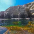
19. Go Tide Pooling (Winter and Early Spring)
Location: Multiple spots (see my guide to La Jolla tide pools for directions)
Cost: Free
Time needed: 1–2 hours
Best time to visit: Winter and early spring during minus tides; check local tide charts for negative tides during daylight
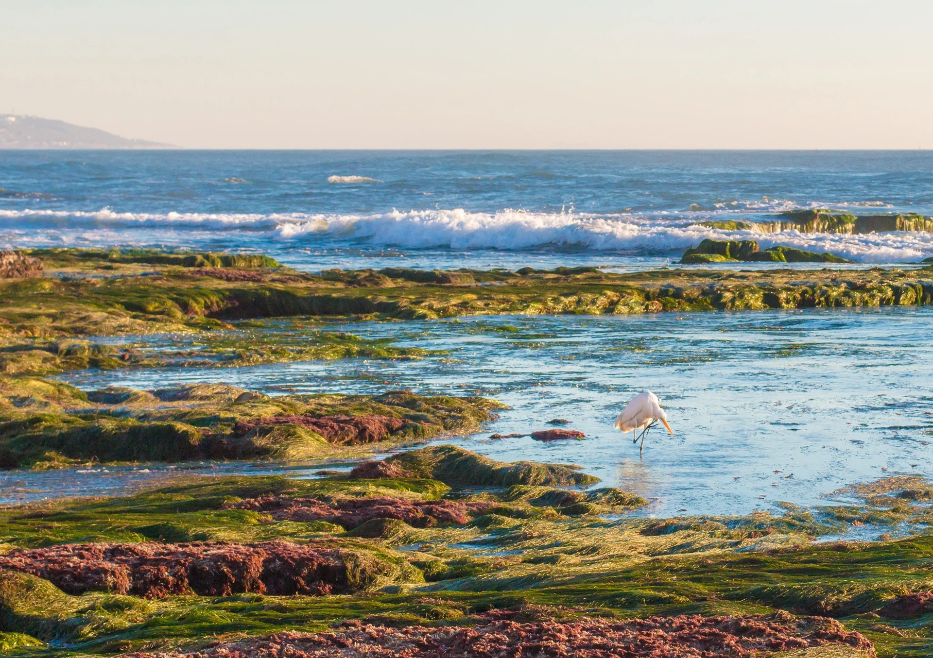
During winter, when low tides occur during daylight hours, many residents and tourists flock to the best beaches for exploring La Jolla tide pools. You’ll see a variety of sea creatures, ranging from hermit crabs to octopuses to sea anemones.
A good rule of thumb is to check the local tide calendars online. If you see a minus tide, that’s your cue to head to the beach. Two great spots are behind the Children’s Pool or north of Scripps Pier at Dike Rock.
Even better, book a Birch Aquarium Tidepooling Adventure, which we have personally enjoyed. Their naturalists have a knack for spotting critters and explaining how they live.
20. Walk the La Jolla Murals (Some Are Great for Photos)
Location: Various locations throughout The Village (download a map at muralsoflajolla.com)
Cost: Free for self-guided; the Athenaeum walking tour is also free
Time needed: 1–2 hours for the full self-guided tour
Best time to visit: Anytime; last Wednesday of each month at 5:30 p.m. for the guided walking tour
Look for our La Jolla Murals sprinkled around town on billboards and buildings. These are part of a privately funded community art program by the Athenaeum designed to add a new layer of vibrancy to our seaside community.
Each mural is on display for up to 2 years. The Athenaeum hosts walking tours on the last Wednesday of the month at 5:30 p.m., lasting about 90 minutes and covering roughly half of the fifteen murals.
21. Play with Rescues at the Cat Lounge
Location: 1600 Torrey Pines Road, La Jolla, CA 92037
Cost: $25 admission (tax-deductible; check website for current pricing)
Time needed: 30 minutes to 1 hour
Best time to visit: Book ahead online as sessions fill up
The idea behind this nonprofit organization is simple. Every cat in The Cat Lounge is rescued from a local high-kill shelter and is ready for adoption.
You can pay a tax-deductible admission to read, relax, take Instagram photos, and play with cats. Feel good that all revenue goes to rescuing and caring for cats.
If you want to adopt a cat, it’s a great way to meet your future family member. Kids under 14 need to be accompanied by an adult.
22. Take a Salk Institute Architecture Tour
Location: 10010 N Torrey Pines Road, La Jolla, CA 92037
Cost: $25/person (reservation required)
Time needed: 1–1.5 hours for a guided tour
Best time to visit: Midday for the iconic courtyard light; reservations required in advance
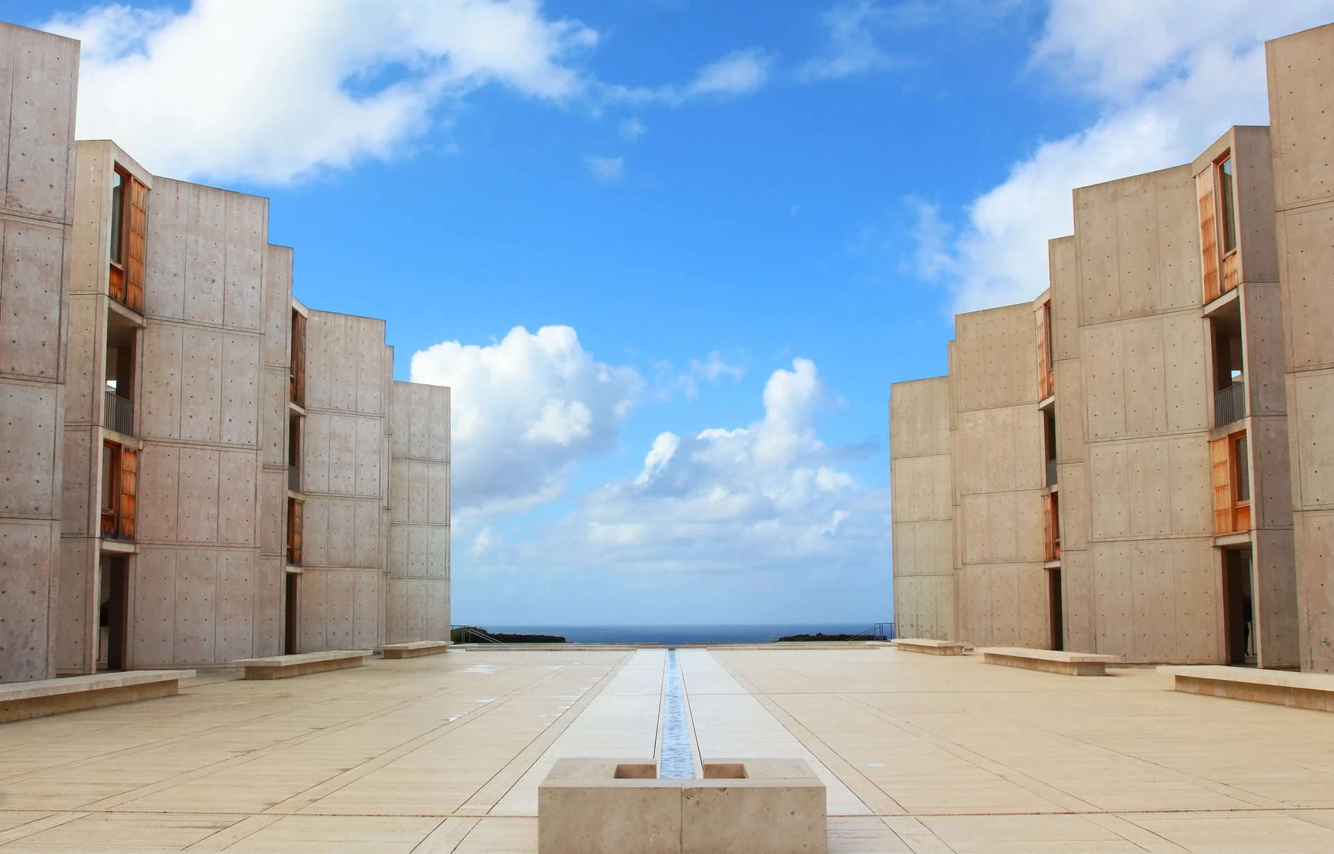
People who are interested in architecture should visit the Salk Institute. Jonas Salk partly designed the designated historic site to encourage creativity. After all, it’s a biomedical research facility.
The Salk Institute is known for its bold design, open labs, and great ocean views. You can tour it on your own or with a guide, but you need to make reservations either way.
23. Enjoy Local Flavors in the Bird Rock Neighborhood
Location: 5600 La Jolla Blvd, La Jolla, CA 92037 (heart of the neighborhood)
Cost: Varies by restaurant
Time needed: 1–2 hours
Best time to visit: Morning for Bird Rock Coffee and Wayfarer Bread (go early, they sell out)
The cozy Bird Rock neighborhood is just a few miles from the popular Village of La Jolla. It covers several small blocks on La Jolla Blvd, roughly between Camino de la Costa and Midway Street. I live just up the hill, so I spend a lot of time here. Here are some places you should check out:
- Bird Rock Coffee: A locally famous place for your morning or afternoon cup.
- Wayfarer Bread: Go early for a loaf or croissant (they sell out), but they do offer sandwiches and pizza later in the day.
- Dodo Bird Donuts: Go for a fancy donut or gourmet breakfast sandwich.
- Beaumont’s: Neighborhood eatery for lunch and dinner, plus brunch on weekends.
- Wheat and Water: Another neighborhood spot for good pizza and salads.
- Surf Shops: Bird Rock Surf Shop has been around for ages (pick up beach essentials, wetsuit, board, or smoothie), and there’s the new Hermosa Surf (sustainable hand-shaped boards, lifestyle, and smoothie shop).
24. Go Shopping in The Village
Location: Mostly Prospect and Girard Streets
Cost: Free to browse
Time needed: 1–3 hours
Best time to visit: Weekday mornings for easier parking; afternoons for a full browse-and-dine experience
Prospect Street, with its boutiques and art galleries, is considered the Rodeo Drive of San Diego County. Its intersecting streets, like Girard Avenue and Ivanhoe Avenue, also have some shopping gems worth checking out.
The list of best places to shop in La Jolla is long, but my favorite locally owned store for gifts and books is Warwick’s. Lululemon, Aviator Nation, Vuori, and other casual shops dot the streets.
Be sure to stop in one of our outstanding restaurants between stores for a meal or coffee.
25. Browse Local Produce and Crafts at the La Jolla Open Aire Market
Location: 7337 Girard Avenue, La Jolla, CA 92037 (La Jolla Elementary School)
Cost: Free to enter; bring cash for purchases
Time needed: 30 minutes to 1.5 hours
Best time to visit: Sundays only, 9 a.m. to 1:30 p.m.; arrive early for the best selection

Our Farmers Market is called the La Jolla Open Aire Market. It takes place on Sundays between 9 a.m. and 1:30 p.m. at La Jolla Elementary School on Girard Avenue and Genter Street.
You can go to the market to buy fresh produce, flowers, olive oils, spreads, baked goods, crafts, and seafood to cook at home. If you’re visiting La Jolla and looking for epicurean souvenirs, they’re here, too.
However, it’s a favorite spot for prepared foods, ranging from avocado toast to excellent burritos, that you can eat at the market on picnic tables or lawns. We also often take these meals to go.
26. Learn About Our Past at the La Jolla Historical Society
Location: 7846 Eads Avenue, La Jolla, CA 92037
Cost: Free
Time needed: 30 minutes to 1 hour
Best time to visit: Wednesday through Sunday, noon to 4 p.m.; check for special exhibitions and seasonal events
Visit the La Jolla Historical Society’s exhibition galleries inside its Wisteria Cottage location on Prospect Street.
Exhibitions honor the people, events, and architecture that helped shape La Jolla into the vibrant community that it is today. The museum is typically open from noon to 4 p.m. on Wednesday to Sunday, but check the calendar.
Spring Events
27. Walk the Scenic Coast Walk Trail
Location: 1325 Coast Blvd, La Jolla, CA 92037 (near Cave Store in Village)
Cost: Free
Time needed: 30–45 minutes one way
Best time to visit: Morning for fewer people on the trail; clear days for the best ocean views
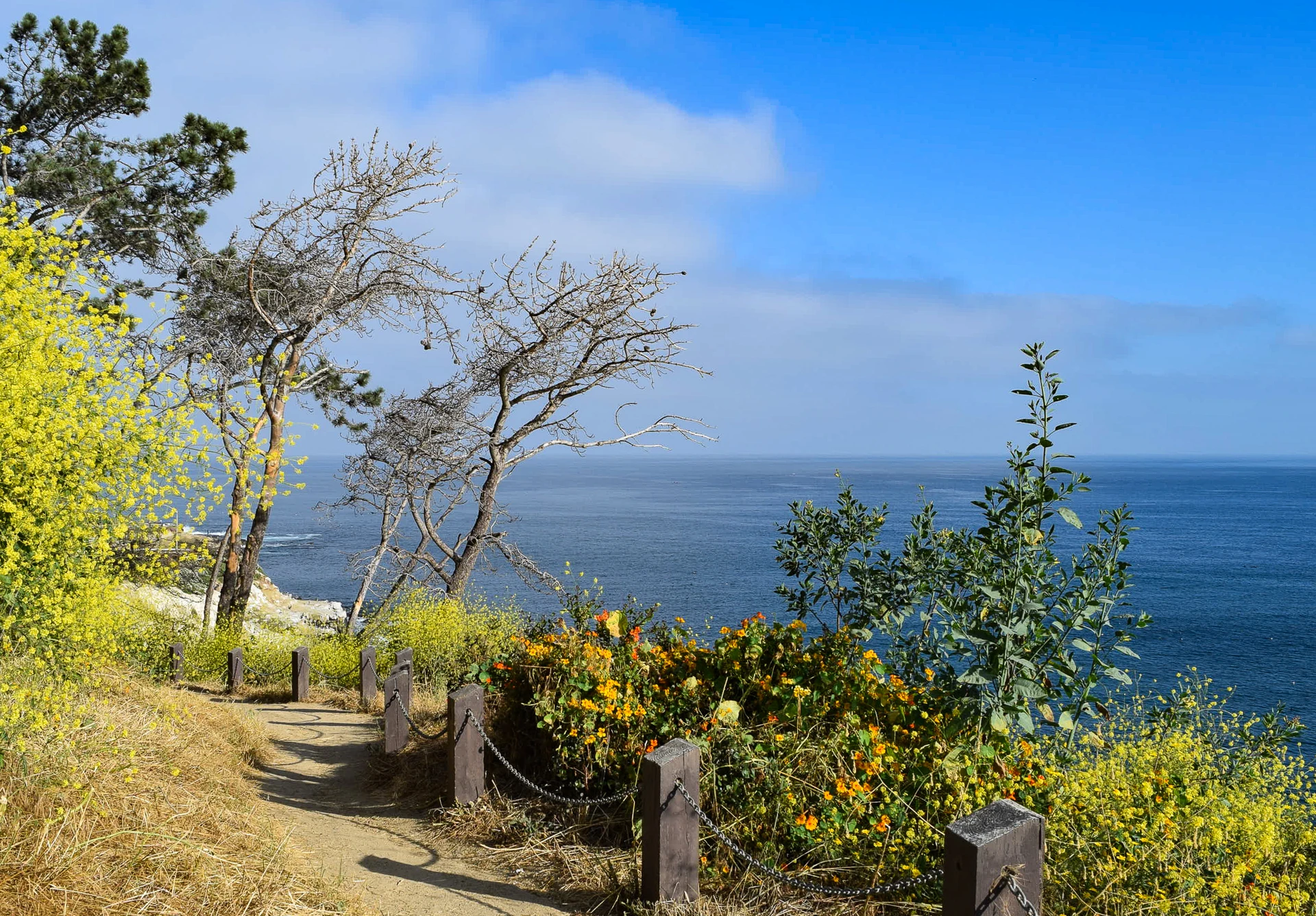
If you want to walk to La Jolla Shores from the Village, take the Coast Walk Trail (also called the La Jolla Walking Trail) north for about a half-mile. The trail’s entrance is near The Cave Store on Coast Blvd.
The dirt path wraps along the coastline, offering gorgeous views of the ocean and sea lions. The trail is easy, and there are benches to sit on so you can stop and enjoy the view.
28. Watch a Movie at The LOT Luxury Cinema
Location: 7611 Fay Avenue, La Jolla, CA 92037
Cost: Tickets from ~$18–$25; food and drinks extra
Time needed: 2–3 hours
Best time to visit: Rainy days or matinees; get your parking validated
Of course, La Jolla has a luxury movie theater. Before and during the movie, you can order food and cocktails from your plush reclining seat.
The LOT was designed as a lifestyle space. It also offers an expansive patio, where we have attended several events, as well as a restaurant and bar inside. It’s a good option when looking for what to do in La Jolla on a rare rainy day. We go there all the time, and so do our friends.
There’s underground parking, but you MUST get your ticket validated.
29. Dine at Our Fantastic La Jolla Restaurants
Location: Throughout The Village and La Jolla Shores
Cost: Varies widely by restaurant
Time needed: 1–2 hours per meal
Best time to visit: Reserve ahead for popular spots like George’s and NINE-TEN, especially on weekends

The list of La Jolla restaurants we love is long. Whether you’re coming for breakfast, brunch, lunch, dinner, or dessert, we have you and every dietary restriction covered. Here’s my Cliff Notes version to dining.
Many La Jolla residents take visitors to George’s Ocean Terrace for casual alfresco dining. The menu focuses on locally sourced seasonal ingredients, and the view overlooks La Jolla Cove. San Diego locals also come in on day trips to dine here.
Brockton Villa, overlooking the Cove, is a historic cottage-turned-restaurant famous for its Coast Toast (brioche French toast dipped in cream) and its charming ambiance.
If you’re craving Mexican food, we like Puesto for street tacos, and the lines at the Taco Stand on Pearl Street form for a reason. For date nights, we head to award-winning NINE-TEN for farm-to-table cuisine and good wines, but we also quite like martinis and oysters during happy hour with a view at Eddie V’s.
Craft beer is easy to find at most of our restaurants, though La Jolla doesn’t have a specific brewer. Trilogy Sanctuary hosts outstanding yoga classes and is home to a vegan restaurant that even non-vegans adore.
For dessert, try the artisanal gelato at Bobboi Natural Gelato near the Cove, and any cupcake, cookie, or baked good at Sugar and Scribe. I often meet my friends for breakfast at the latter, too.
30. Take a Guided Sightseeing or Food Tour in La Jolla
Location: La Jolla Shores (water sports) or The Village (walking tours)
Cost: Varies; kayak tours from ~$50–$80, Segway tours ~$80+, walking tours free to ~$75
Time needed: 1.5–3 hours, depending on the tour
Best time to visit: Book in advance, especially in summer; mornings are best for water tours
Stay tuned for a full post on this, but lately people have asked me for sightseeing tour suggestions. Our La Jolla museums are great resources for free walking tours.
In addition to the Athenaeum murals walking tour and the Salk Institute tour mentioned above, consider the following La Jolla tours.
I have affiliate relationships with some La Jolla tour companies, which means that I might be compensated if you book using my links.
- Socal Riviera Electric Bike Tour: San Diego Flyrides will take you up hills for panoramic views and down the coastline for ocean views, La Jolla Cove, and seal viewing.
- Segway tour: If you’ve never driven a Segway, here’s your chance. It’s actually quite fun and easy to do after a quick tutorial. These tours last two hours, rain or shine, and pass by beaches, our murals, the seals, boutiques, and more.
- La Jolla Historical Society Self-Guided Walks: Tour at your own pace with themed walks, including A Walking Tour of La Jolla Village, Historic Beach Cottages of La Jolla, and more.
- So Diego Tours: They have a NEW food walking tour of La Jolla that you should try! Use promo code lajollamom for $5 off.
- A guided La Jolla kayak tour of our sea caves: We have multiple companies that offer kayaking tours and snorkeling tour options, and they’re all great. You’ll get some exercise, see some fish and sea lions, and enjoy a great day out in Southern California’s sunshine. Some of these tours let you get out of the kayak and snorkel.
Exclusive Everyday California Discount
Use code LJMOM20 for a 20% discount on kayak and snorkeling tours, lessons, and rentals.
FAQs About Things to Do in La Jolla, San Diego
Get more information about La Jolla, CA, including why you should visit, places to see around town, the best beaches, and advice for your trip.
Is La Jolla worth visiting?
As a resident, I would definitely say yes. La Jolla’s name means “The Jewel” in Spanish, which fits a community surrounded by stunning coastline. We have some of the best restaurants in San Diego, beautiful beaches, boutique shopping, art galleries, and ocean views that even many San Diego locals make day trips to enjoy.
The vibe is fairly laid-back for an upscale community. Once you park in the Village of La Jolla (admittedly, this can be challenging in summer), you can easily walk to La Jolla Cove, restaurants, and shopping. The same goes for La Jolla Shores, where you can park, go to the beach, and walk to lunch or happy hour in the business district.
What can you do in La Jolla for a day?
The short answer is a lot, but what you choose depends on the type of adventure you want. I have listed ways to structure a day in La Jolla, broken down into morning, afternoon, and evening, with suggestions for activities and restaurants in the neighborhoods you might find yourself in.
Refer to how to spend a day in La Jolla for more information.
What is La Jolla famous for?
La Jolla is famous for:
Seals and sea lions.
Expensive homes.
UC San Diego.
Torrey Pines Golf Course (where the Farmers Insurance Open PGA tournament is held).
Ocean views.
Sparkling beaches and surfing.
Leopard sharks.
Residents such as Dr. Seuss and the myriad of entertainers and politicians who have homes here (Alicia Keys and more).
Ecological Reserve tours to see the sea caves and marine life by kayak, SUP, or snorkeling.
What are the best things to do in La Jolla with kids?
As a mom in La Jolla, I have written an exhaustive guide to what to do in La Jolla with kids. The most popular activities for children include:
La Jolla seals and sea lions.
Birch Aquarium at Scripps.
La Jolla Shores Beach.
Parks and playgrounds like Kellogg Park and La Jolla Recreation Center.
Family hikes at Torrey Pines State Natural Reserve.
Visiting the La Jolla tide pools during the winter.
What are the best free things to do in La Jolla?
I have written an extensive list that details what to do in La Jolla for free. Many people take day trips to La Jolla specifically to see our seals and sea lions in addition to our pretty beaches, which are completely free outdoor activities.
If free street parking isn’t available, you may have to pay a little cash for parking. Otherwise, it’s possible to enjoy a visit on a budget.
Where’s the best place to walk around in La Jolla?
You can walk around the Village of La Jolla, our downtown area. This is where the best shops and restaurants are. It’s one of my favorite fun things to do in La Jolla when I have free time.
It’s also nice to walk around the La Jolla Shores business district, though it is significantly smaller.
Is La Jolla Beach swimmable?
Most of La Jolla’s beaches are swimmable. The best places to swim are La Jolla Cove and La Jolla Shores beaches. I’d avoid swimming at WindanSea unless you’re an experienced surfer due to the intense shore break.
Is La Jolla Beach free?
Yes, it is free to spend a day at La Jolla beaches. Our fantastic weather makes the beaches usable year-round. Be mindful that free parking in peak months is limited, so you may need to find a paid parking lot.
What are the best things to do near La Jolla?
If you’re staying in a La Jolla hotel, its central San Diego area location provides easy access to sights in other parts of the county that people commonly visit, including:
Mission Bay.
Downtown San Diego (USS Midway Museum, Little Italy).
San Diego Zoo.
Balboa Park.
SeaWorld San Diego.
LEGOLAND California.
Those taking day trips to Orange County or Los Angeles can drive or take the train. We catch the train to Disneyland from the Old Town Transportation Center. The same Amtrak train will pass through downtown Los Angeles.
What is there to do in La Jolla for couples?
La Jolla is one of the most romantic spots in San Diego. For a memorable date, start with a sunset walk along the Coast Walk Trail or at Scripps Park overlooking La Jolla Cove. Book a table at NINE-TEN for farm-to-table dining, or try cocktails and oysters during happy hour at Eddie V’s.
A tandem paragliding flight from Torrey Pines Gliderport is an unforgettable shared experience. For a quieter day together, kayak through the sea caves, explore the galleries at the Museum of Contemporary Art, or browse the boutiques on Prospect Street before grabbing gelato at Bobboi.
What is the best time of year to visit La Jolla?
La Jolla is a year-round destination thanks to San Diego’s mild climate, but each season has its perks. Summer (June through September) brings the warmest water, the best beach weather, and the famous leopard sharks at La Jolla Shores. Fall is my personal favorite because the crowds thin out, the weather stays warm, and the water is still pleasant. Winter and early spring are best for tide pooling and watching harbor seal pups at Children’s Pool (pupping season runs December 15 through May 15). Whale watching from the Torrey Pines cliffs is also a winter highlight.
How do I get to La Jolla from downtown San Diego?
La Jolla is about 12 miles north of downtown San Diego, roughly a 20-minute drive without traffic (allow more time during rush hour or summer weekends). You can also take the bus (routes 30 and 150 connect downtown to La Jolla), though a car or rideshare is much more convenient for getting between La Jolla’s different neighborhoods. See my guide on getting to La Jolla.
What are your favorite things to do in La Jolla, California?

Katie Dillon


Leave a Reply